- Start: Duncan Mills, California
- Finish: Samuel Taylor State Park, Marin County, California
- Distance: 78.8k
- Elevation: 1044 meters
- Optional Distance: 55.1
- Optional Elevation: 811 meters
It was an interesting day today. We transitioned from forest to grasslands and spent most of the day rolling through the golden hills that gave California its name as the golden state.
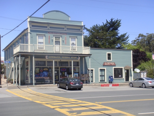 After leaving camp we picked up the Bohemian highway after only a short distance. That stretch does have some very colorful little towns such a Monte Rio, Occidental, and my personal favorite Freestone. I spent quite a bit of time in Freestone because they had cell phone coverage. From there we headed over to the coast and rode along the eastern edge of the Tomales Bay. At the top of Tomales Bay is the little town of Tomales.
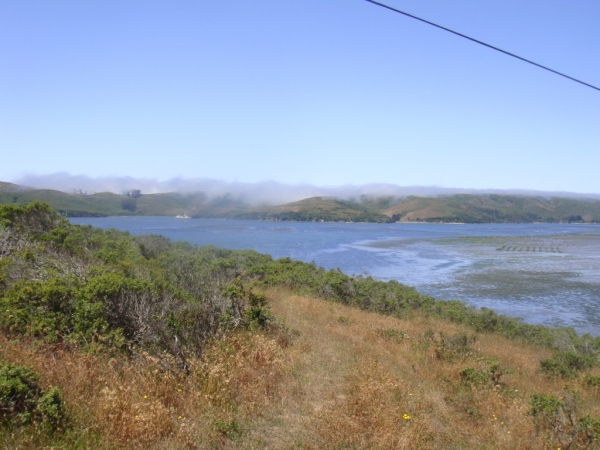 Tomales Bay is famous for its clams, so not surprisingly we are seeing the same kind of mud flats we saw in Washington clam country.
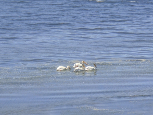 Tomales bay is also an important wildlife area. After several attempts I was able to get a nice shot of 4 storks feeding in the shallows of Tomales Bay.
Our camp for tonight is at the base of mount Tamalpais. So after pitching my tent and a few other things I decided to see if I could make it to the top of Tam. 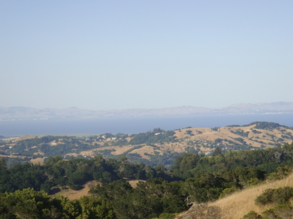 Unfortunately I didn’t have a chance to plan the route before hand and had to rely on Garmin routing. Garmin lived up to it reputation and I shortly found myself at a dead-end. By the time I found the correct route I had burned to much time and energy to make it to the top. However I was able to get our first few of the Bay.