From Monday September 24 to Friday September 28, twenty-two CCCTS members did a Hub & Spoke on Manitoulin Island. We stayed at the two motels in Manitowaning. Both were excellent value. The owners were delighted to be full for five days in the off season and bent over backwards to make us feel welcome. Manitoulin Island, in Lake Huron, is the largest fresh water island in the world. It is 123 kilometres from east to west and 48 kilometres from north to south, with an area of 2,766 square kilometres. On Manitoulin Island itself, there are 108 lakes, the largest of which is Lake Manitou, which has an area of 104 square kilometres and is 19 kilometres long. Lake Manitou is the largest lake in the world on a fresh water island. Treasure Island in Lake Mindemoya (the third largest lake on Manitoulin Island) is the largest island in a lake on an island in a lake in the world. Treasure Island does not have a lake, but some of the islands in lakes on Manitoulin Island do have ponds. No doubt, one of these ponds is the largest lake in an island in a lake in an island in a lake in the world. Now, you may legitimately ask whether any of these ponds have islands. Unfortunately, I regret to say the author’s expertise on this important matter is exhausted.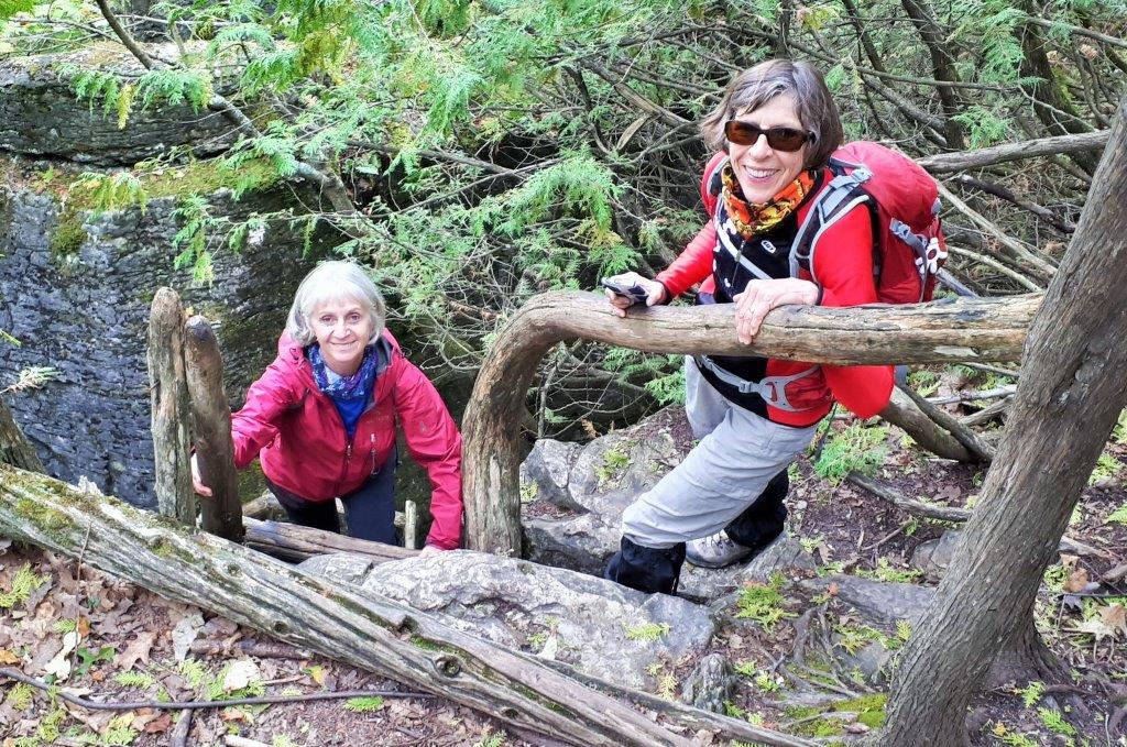
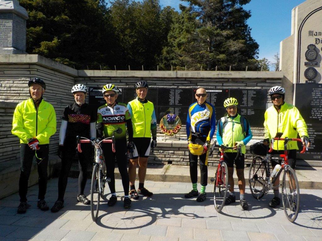
Manitoulin Island is an oasis of road biking in Northern Ontario. Angus, the chief inspiration for the trip, is from nearby Espanola. If you want to road bike around Espanola you are pretty much restricted to the Trans-Canada Highway, or Highway 6. Neither of these two roads are bike friendly. In Mattawa, on our drive back to Ottawa, we chatted with a local road bike enthusiast in the Tims parking lot. In Mattawa the situation is even worse. There really aren’t any places to ride other than the Trans-Canada Highway. Manitoulin Island, on the other hand, has a lot of paved roads even though the permanent population of the island is only 12,000. The busiest road on the island is highway 6 which runs north south. It has a nice paved bike shoulder for more than half its distance and they are working on the rest. Highway 540 is the main east west road and it has a good paved bike shoulder near Little Current, the largest village on the island (population 1500). As you go further west, the paved bike shoulder disappears, but so does the traffic. We rode a fair bit on this western section of 540 and it was great for biking. This was in September; it might be a lot busier in July and August. There are other highways on the island that are paved and fine for biking. A good number of the secondary roads are also paved and bike friendly. All this is in stark contrast to most areas in Northern Ontario where country roads are not good for road bikes.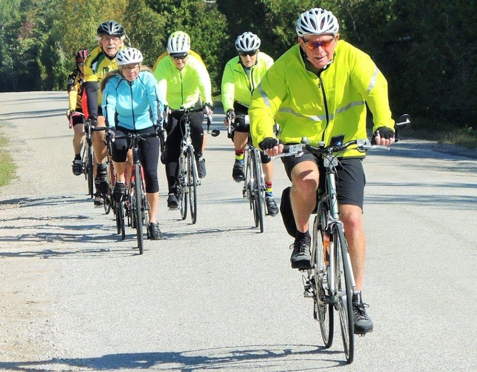
On Manitoulin Island, there is not a single restaurant franchise, no McDonalds, no KFC, no Swiss Chalet, not even a Tims. What a wonderful change of pace it is to spend five days in such a place. Many of the places we did eat, all handpicked by Angus, had wonderful character. The best were Rocky Raccoon in Gore Bay, Garden Gate in the middle of nowhere, Quintina’s in Spring Bay (as close to being in the middle of nowhere without actually being nowhere), Main Street Café in Kagawong and North 46 in Little Current.
Although Manitoulin Island is an island and Torontonians inevitably arrive there by ferry from Tobermory, you can actually drive onto the island across the swing bridge at Little Current. As the name suggests, there is a current in the narrows under the swing bridge. This is the middle of a huge lake. How can there be a current? Three of the finest minds in CCCTS (John, Richard H, and Tom) have left no stone unturned in investigating this question. Much progress has been made, but much remains to be done. An enormous amount of water flows into Lake Huron from Lake Superior. If you look at a map you will see that this inflow is choked by Manitoulin Island and two islands immediately west of Manitoulin. So it does make sense that there should be current in the four narrow channels where all of the water from Lake Superior must pass as it travels from the North Channel into the main body of Lake Huron. Little Current is the narrowest of these channels so the current should be most concentrated here as it flows east into Lake Huron. Unfortunately, little escapes the notice of our three fine minds. On Sunday, the day we arrived on Manitoulin, we all observed the current running west. Our good friend Google has been no help in dealing with this conundrum. John called the town office and was assured that the current flows east. When he said that we had seen it flowing west, he was treated to some very unsatisfactory double speak. I emailed the Manitoulin Island website with my questions and received a prompt reply, the sender assuring me that they knew not a thing about the current at little Current, but would get right on it. Have not heard further. Perhaps, once these issues are resolved, CCCTS will want to devote an entire issue of Newsbrief to this question.
Manitoulin Island has a very irregular coast line with many deep bays. Surprisingly, the island is very flat. It seems to be covered with flat stratified rock. 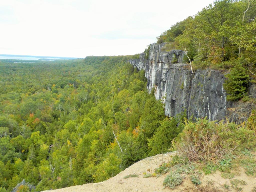 There are a lot of cattle pastures on flat barren land. Some of the “fields” are so barren that there is only a little scrub amidst large slabs of rock. The following website has an interesting discussion on the geology of the island and some great photos of the flat rock fields. We rode right by the site on Monuments Road that is featured in the website.
https://www.northernontario.travel/northeastern-ontario/understanding-manitoulin-rocks-and-alvars
On Monday we started at the Cup and Saucer Trailhead. This is a hiking trail that goes to the highest point on the island. 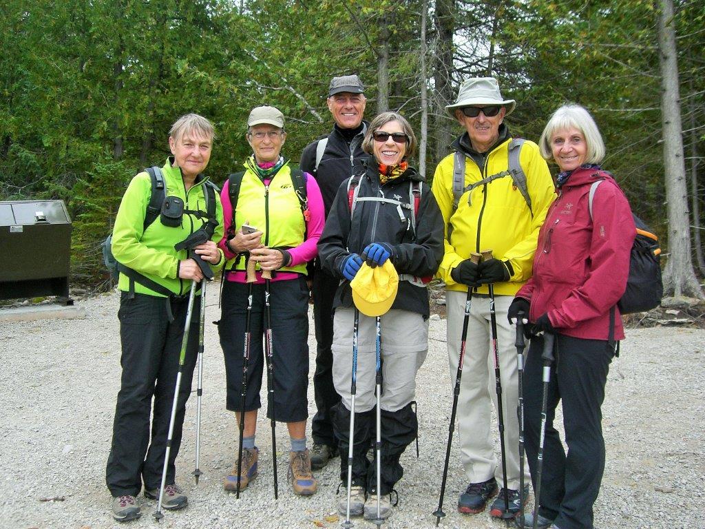 Half a dozen of us did the hike and the others rode towards Providence Bay – a bay on the south side of the island with a lovely sand beach about one mile long.
 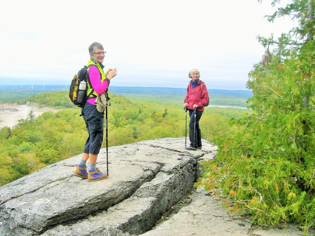 In the evening we went to Red Lodge on Lake Manitou for Supper. An interesting place, but I think that many agreed it was the least satisfying of all the places we had dinner.
The weather forecast on Tuesday suggested that it could rain all day, but there might be a break around 10:00am. At 10:00 we dutifully set out and got about one kilometre when it started to rain. At that point, about half a dozen of us turned back while the rest pressed on to our destination – South Baymouth. The rain wasn’t too bad (but it wasn’t too good either). The closer we got to South Baymouth, the foggier it became, so we had no fabulous views over Georgian Bay. We had lunch at the Pierside Restaurant. It is right where the ferry for Tobermory docks and it is the only obvious restaurant in town. We took over a long table for 14. Right beside us was an equally long table where a bunch of ladies with funny red hats and purple clothing were gathered. There was speculation over who looked more bizarre – we in our wet cycling gear, or the ladies who were having a jolly time. It stopped raining before lunch and never rained again (that day). On the way back, we passed the prudent few who had waited out the rain. They were merciless in razzing us because we didn’t have enough sense to stay out of the rain. For dinner we went to the Garden Gate. It is the best restaurant on the island and in the middle of nowhere – somewhat closer to South Baymouth than to Manitowaning.
It was never warm on Manitoulin. It was three degrees on the day we drove from Ottawa and it was four degrees when we departed the island. That was the coldest of the weather. Wednesday was a sunny day, not warm but windy. We drove to Gore Bay for the start – a drive of about one hour. We rode into the wind to the causeway by Lake Wolsey (fourth largest lake on Manitoulin). On the way we sighted a flock of several Sandhill Cranes. After the causeway we cruised with the wind at our backs all the way to Kagawong. When we got to the lunch spot described by Angus, we looked around and found nothing. There was a building there, but it didn’t look like a restaurant. Nonetheless, it was a restaurant and a local gem. They had great soup and salads. After lunch, we checked out Bridal Veil Falls. 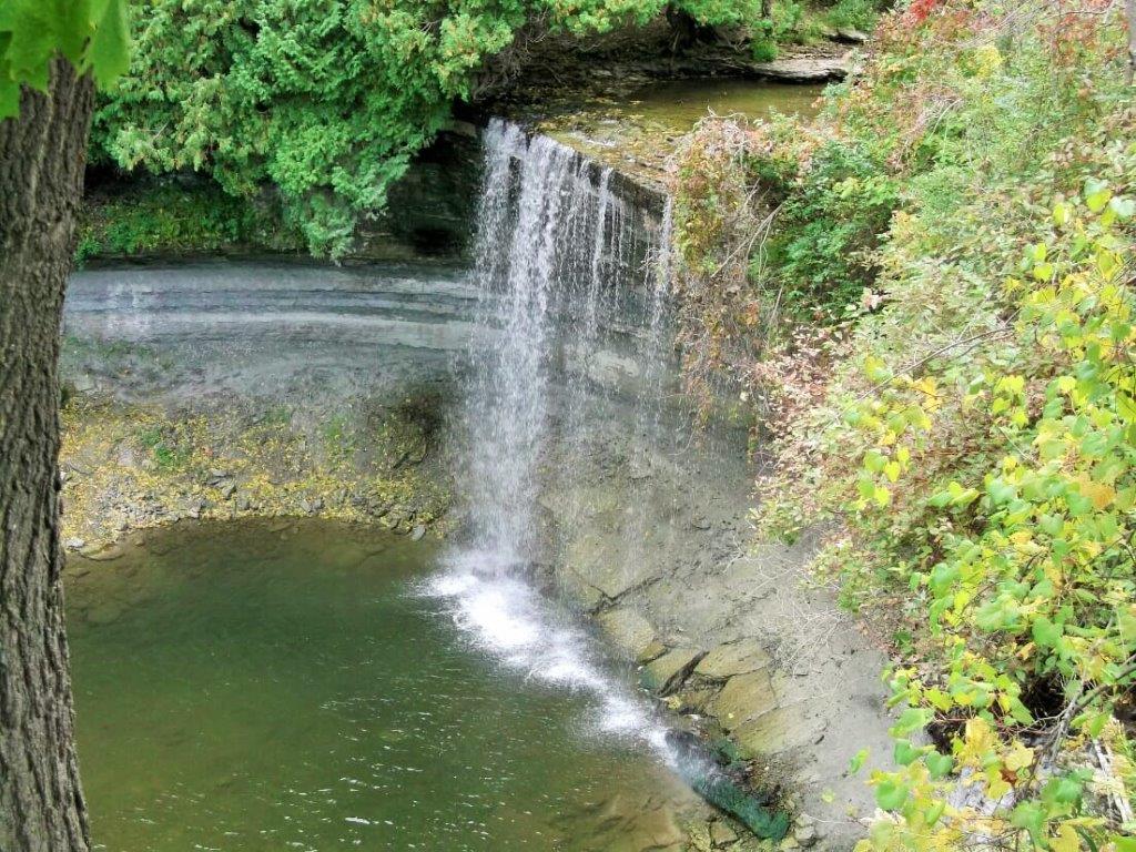 It is a lovely falls with a tiny shallow pool beneath, where Salmon spawn. The salmon have to swim upstream from Georgian Bay less than a kilometre to get there. Unfortunately, beavers have dammed the stream just above the falls and only a trickle is getting through. The stream below the falls is too shallow for the salmon to swim through. We went down to Georgian Bay and saw three big salmon trying to make it, but there was no possibility. It was very sad to consider how cruel nature can be, so we went to the local chocolate shop and gorged ourselves into forgetfulness. For dinner, we went to Rocky Raccoon in Gore Bay. How can you pass up a place whose name suggests their specialty is road kill? The building itself was quite unusual. It was octagonal, all wood construction, three stories, high ceilings and excellent acoustics. I often have difficulty hearing in restaurants, but, in this room I could hear from one end of the table to the other. Why aren’t all restaurants like this? We were greeted by a very energetic gentleman who took our orders, told us the history of the building and his own story, cooked the food and served us, all in a very timely fashion. The food was excellent.
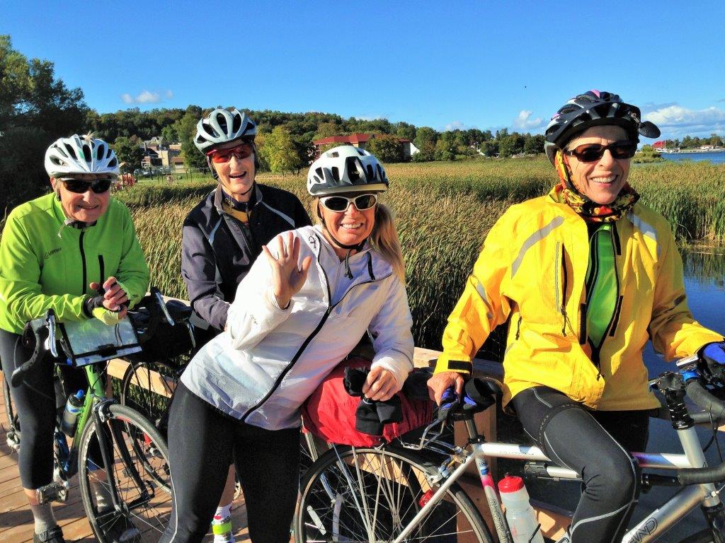
We started Thursday by driving to Providence Bay. On the way we stopped to take photos of a huge flock of Sandhill Cranes who were spread over an enormous recently harvested cornfield. We lunched at Quintina’s Clothier and Guest House in Spring Bay. Another gem with wonderful crepes and desserts. But the highlight was the décor. It was a place you could buy dresses and sundries while sitting in period furniture. Completely incongruous and delightful. It was so amazing that we stopped there again for a snack later in the day. At that point, Quintina was entertaining friends. We sat down and were part of the company. When we got back to Providence Bay, several people were fishing off the beach. What could they possibly be catching off a beach, thought I. They were catching salmon – great big ones. For dinner, Joanne and Sandra organized a BBQ back at the motel. A good time was had by all.
Friday was another rainy day. We didn’t set out to ride until one in the afternoon. Somehow, Nel’s bike got locked onto my bike rack and she was unable to ride. Darned if I know how that happened. Anyone with information on this should contact me. We rode along Highway 540 from Little Current and got some great views of the North Channel. After the ride we stopped at 10 mile point for some photo ops. Dinner again at the Garden Gate.
Saturday morning was a beautiful clear cold sunny day. The drive back was wonderful in the early autumn colours until North Bay. Then it started to cloud over and spit. Thanks to Angus and Nel for organizing a wonderful Hub and Spoke.
Tom Wiley