Author: George Aitken
May 1st – 13th 2009
Leaders: Robin Howe & Dan Carey
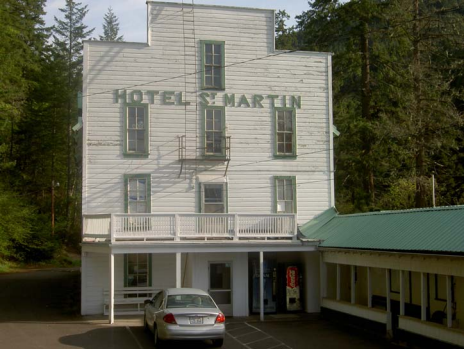
Robin and Dan Carey have been members of CCCTS since 2003. From 2004 onwards they have conducted an annual tour of their native Washington, usually in the eastern part of the state, but for a change this year decided to focus upon southwestern Washington beginning with a four-day hub-and-spoke based in Centralia, a historic town that was on the Oregon Trail (1843-1857). Save for the railroad, which still comes through town, time has unfortunately passed Centralia by, but we were fortunate to stay in a remnant of the past – the Olympic Gentlemen’s Club Hotel and Theatre which in the roaring 20s provided food and lodging for miners on their days off, besides acting as a “speakeasy” in prohibition days.
The rooms were variable. The couples generally had very comfortable rooms, whereas the singles ended up in interior rooms without any windows and bunk beds. Did I mention the railroad comes through town still – 25 Amtrak passenger trains per day, and GOK how many freight trains? Here comes the 4:09 – a.m.! … The Olympic Club’s website indicates “while in your room you may hear the sound of trains rolling through the night on the nearby track … However, complementary earplugs are provided in the rooms for our guest’s comfort”. There was complementary admission to the movie theatre, but the feature film usually did not begin until 9:00 p.m., by which time most of our number were fast asleep. On balance though this unique accommodation was much preferred over a Motel 8!
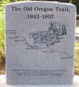
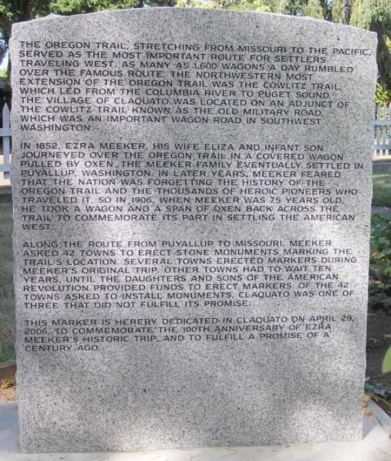
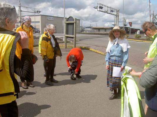
 Centralia provided an excellent base for our hub-and-spoke. On day one, unfortunately one of several wet days, we set out on a Lewis County cruise, starting out with a visit to Claquato Church. The church was closed but the churchyard had an interesting memento of the Oregon Trail which began in Independence, Missouri and ended in Tumwater, just south of Olympia, the State Capital of Washington.
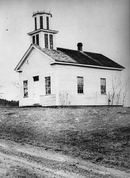
The church was used from 1858 until the 1930s and then restored in 1950. It was the third church built north of the Columbia River and it is the oldest remaining protestant church in the Pacific Northwest; still in its original location, and still has its original structural form.
Credit for founding the town of Claquato goes to Lewis Hawkins Davis who came west in 1852 from Indiana. As time passed, Claquato became a lumber town with a sawmill built by Davis who insisted that the first buildings be those that would contribute to the growth of the town. The first was a Courthouse finished in 1862. The town continued to prosper under Davis’ leadership until his death in 1864 as a result of injuries sustained in a fall at his mill.
Many towns and settlements died when bypassed by the railroad – such was the case with Claquato when rails were laid in 1874. The church wasn’t open but the “outhouse” was which provided comfort for many of our participants!
We carried on then to lunch in light rain, but during the lunch stop “the heavens opened”. By the time we began again it wasn’t too bad for a while then it poured again.
John Turner has a unique way of dealing with the stray dogs that run after us, – he has an old squeaky car horn which he squeaks and the dogs take off. Nice going John!
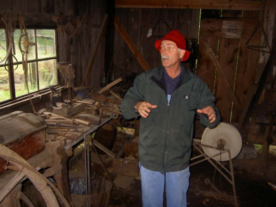
We eventually ended up in Chehalis, at the Lewis County Museum, where we were told of the story of “The Wobblies” – aka the Centralia massacre, which was a violent and bloody incident that occurred on November 11th, 1919 during a parade celebrating the first anniversary of Armistice Day. The conflict involved the American Legion on the one hand and workers who were members of the Industrial Wood Workers (IWW) – also called the “Wobblies” – Union on the other. It resulted in six deaths, an additional number of wounded, multiple prison terms and an ongoing and especially bitter dispute over the motivations, timeline, and events that precipitated the massacre.
It was the combination of several years of “bad blood” between the local legion and the IWW. Both Centralia and the neighbouring town of Chehalis had a large number of WWI veterans, with robust chapters of the Legion as well as a large number of IWW members, some also war veterans.
The subsequent ramifications of this event included; a trial that attracted national media attention; notoriety that contributed to the Red Scare of the late teens and 1920s; creation of a powerful martyr for the IWW; a monument to one side of the battle and mural for the other; a formal tribute to the fallen Legionnaires by President Warren G. Harding and a deep-rooted enmity between the local American Legion and The Wobblies that persists to this day.
Four Legion members died including Warren Grimm, a very distinguished local Husky footballer, lawyer and army lieutenant who served in the American Expeditionary Force to Siberia. Later killed was a Deputy Sheriff and one of the workers. Eight Wobblies were convicted of Second Degree Murder for their roles in the massacre.
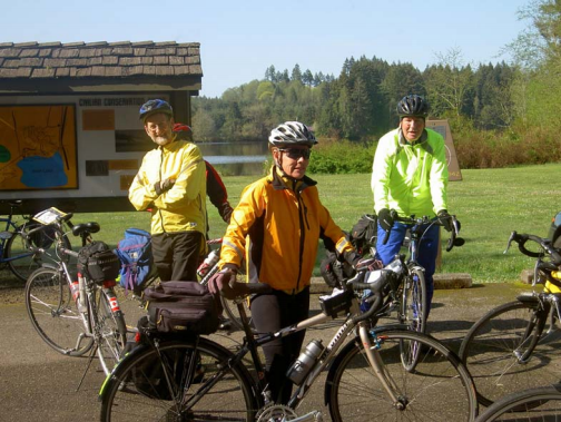
Day 2 saw us taking a half hour drive up to Miller Sylvania State Park. Of passing interest is the fact that Miller Sylvania SP was constructed almost entirely by hand in 1935 by the Civilian Conservation Corps (CCC), a make-work project started by President Roosevelt in the Depression, much as the current Obama administration is seeking make-work projects today.
Those of us who visited Fort Vancouver at the end of the trip were interested to note that the man who had oversight of all the Civilian Conservation Corps activity in Washington State was Major (later General) George C. Marshall, the only military winner of the Nobel Peace Prize. Marshall commanded the forces at Fort Vancouver in the mid-30s.
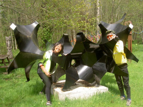
From the start-point in the State Park we accessed the Chehalis-Western Bike Trail which took us past the Monarch Contemporary Art Centre and Sculpture Park – 80 acres of land amid twisting paths, wooded trails and creek-side nooks where the artists had planted up to one hundred fabricated steel statues, stone sculptures and wood carvings.
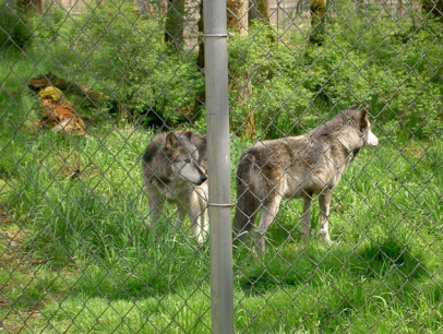 We headed on to the south-east end of the trail at Rainier and then back west on the Yelm-Tenino part of the trail and thence to Wolf Haven International – an organization whose mission is “working for wolf conservation by: protecting our wild wolves; providing sanctuary for captive born wolves, providing wolf restoration in historic ranges; and educated the public on the value of all wildlife”.
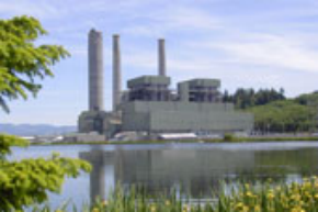 On Day 3 we headed directly east of Centralia to Hannaford Valley en route to Bucoda. The power plant at Hannaford Valley is owned by Trans Alta, an Alberta Company who bought the plant and the adjacent mine in 2000 (a total of 154 million US – 101 million attributed to the sale of the mine and 43 million being attributed to the plant). Subsequently Trans Alta shut down the mine and the coal is now trained in from a Powder River site. Prior to then the plant had been operated by Pacificorp, based in Portland, a unit of Glasgow-based Scottish Power. The generating plant is formally known as the Centralia Thermo-Generating Plant which is an integrated power generation facility with a total of eight generating units, six miles outside of Centralia with the capacity to generate 1,625 megawatts (mw) of electricity for the Pacific Northwest. (It is not to be confused with Hanford, a decommissioned nuclear production complex on the Columbia River in Washington State).
Leaving the power station behind us and turning on to Tono Road, we encountered, not just one but two steep inclines which tested even some of the hill lovers, a third even steeper hill followed in the last quarter of the ride. Unfortunately the rain began again.
Day 4 saw us back on the Chehalis Western Trail, this time riding as far as Yelm with some wind in our faces on the way back but generally a dry ride. The only event of the day was your humble scribe hitting a bollard on the trail at an intersection, describing a fine parabolic somersault, ending up with bike on top, suffering a bruised ego!
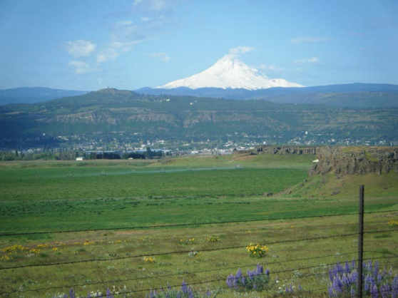
 Day 5 After four days in Centralia we headed south, stopping off at the Mount St. Helen’s Visitor Centre. Unfortunately, like the staff there who said you can only see the mountain fifty percent of the time, we were unable to visualize Mount St. Helen’s, but we had a good tour.
South again down to the Pomeroy Historic Farm (below) in Yacholt, again in the rain, but lunch with afternoon tea style sandwiches was very welcome.
After a brief tour of the working farm we headed down to Vancouver, Washington, ready to start the next part of our tour, four days in the Columbia Gorge – out along the southern shore of the river in Oregon, and back along the northern shore in Washington State.
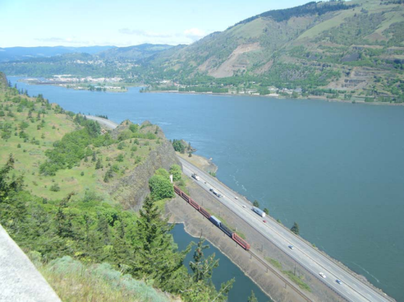
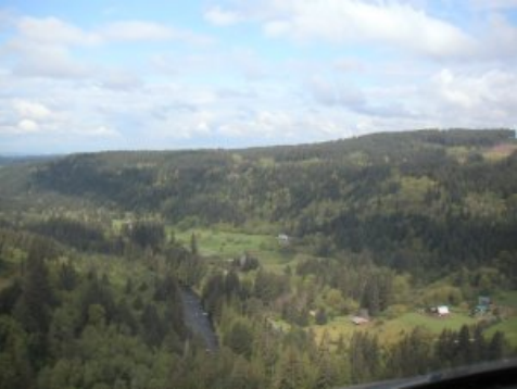
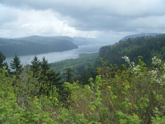
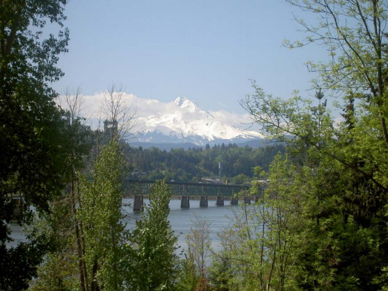
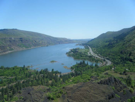
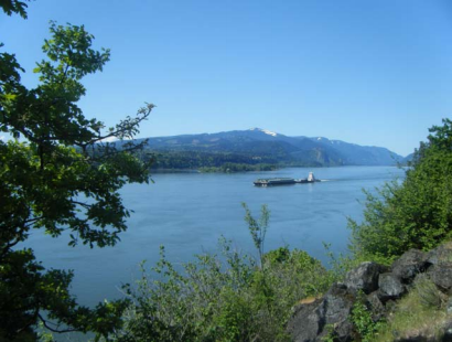
The Columbia River Gorge is a spectacular river canyon cutting the only sea level route through the Cascade Mountain Range. It’s 80 miles long and up to 4,000 feet deep with the north canyon walls in Washington State and the south canyon walls in Oregon State.
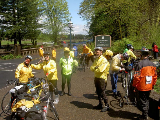
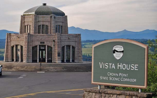 Unfortunately the first day out (day 6 of the tour) heading towards Multnomah Falls for lunch we encountered further heavy rain. One of the exciting views on the Gorge is Vista House on Crown Point Promontory which was begun in 1916 after the dedication of the highway took place at Crown Point. The building was re-dedicated on May 5th, 2006.
 A beautiful view of Vista House can be obtained from the scenic viewpoint overlooking at The Portland Women’s Forum State Scenic Viewpoint on the historic Columbia River Highway State Trail at Chanticleer Point (below).
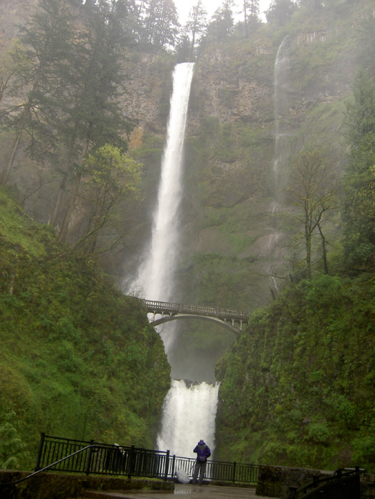 Fortunately in the Multnomah lodge at the foot of the falls there was a roaring log fire in a restaurant which many availed themselves of to dry out
While we were in the parking lot after lunch there was a sudden rifle shot of an explosion, which caught everybody’s attention. – John Hurley, a new member from Courtney, had already repaired a puncture that morning on the way down from Vista House and as luck would have it, it blew again, but with such noise that there must have been some increased pressure on the inner tube. The usual suspects gathered around and changed the tire in no time and we headed on for the remainder of the day to Cascade Locks, most of the way along the Historic Columbia River Highway, ending up with a “portage” down some steps!
The following day (day 2 or 7) we got an early start, accessing the highway again, stopping for hot chocolate in Hood River, the windsurfing capital of the world, but owing to calm winds there were very few windsurfers around. The café in Hood River that we settled upon was the Dog River Coffee Company where they had a sign stating, “Friends don’t let friends drink Starbucks!”
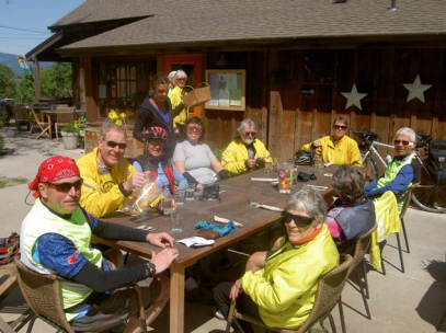 On again to the town of Mosier for lunch at the Good River Café (below) where the weather was finally good enough to dine al fresco.
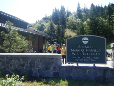 After leaving the café we headed steeply uphill to the start of the Senator Mark Hatfield Trail, named for the former Governor of Oregon and United States Senator (1967-1997).
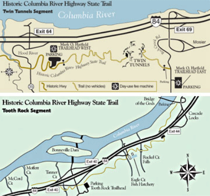 From the west the trail begins with a forest of fir trees and other common western Oregon plants with numerous viewpoints along the 3.5-mile segment, but afterwards the trail passes through the Twin Tunnels emerging into semi-arid terrain dotted with Ponderosa Pine for about a mile.
The Hatfield section actually comprises a part of the Historic Columbia River Highway State Trail, the first part between Hood River and Mosier place is the part where an old US Highway #30 motorist had to creep around curves high along the cliffs of the Columbia River Gorge, but the cyclist has the benefit of the new trail.
The Historic Columbia River Highway was designed by Samuel Lancaster and constructed between 1913-1922. Its purpose was not merely to provide an east-west transportation route through the Columbia River Gorge, but to take full advantage of every natural aspect, scenic feature, waterfall, viewpoint and panorama. When bridges or tunnels were designed they stood by themselves as artistic complements of the landscape.
In its heyday the Columbia River Highway served millions of travelers and became one of the grandest highways in the nation. When transportation needs required faster and larger roads, however, sections of the old highway were by-passed. By 1960 a new interstate highway had replaced nearly all of the older road.
current tour leader Robin Howe at the Rowena Crest Lookout
The four-mile stretch of the old highway between Hood River and Mosier, including the Mosier Twin tunnels was closed, filled with rock and abandoned. In the 1980s new interest in the old scenic highway began to resurface. Lost sections of the highway were identified, unearthed, and studied for potential renovation. Some portions of the original route were covered by I-84 when it was built. An ambitious restoration began with removal of rock from the Mosier Twin Tunnels. Restoration took several months. When workers were done, several surprises were unearthed, such as graffiti dating back to 1921(when drivers were snowbound for several days).
After the Mark Hatfield Trail it was on to the Lewis and Clark Interpretive Centre just outside The Dalles (rhymes with “gals”). This is another Hatfield project, and served to whet the appetite for more on Lewis and Clark and their expedition that began in May 1804 and ended on November 15th 1805 that paved the way for expansion of The United States from Coast to Coast effectively blocking the British influence through Canada and the Hudson’s Bay Territory, leading initially to the Treaty of Ghent (1818), and the Treaty of Oregon (1846).
Meriwether Lewis was appointed by President Thomas Jefferson in 1803 to carry out the expedition, and enlisted Captain William Clark as his Lieutenant. Whereas Clark survived, Lewis unfortunately committed suicide on his return, suffering from depression, before he wrote up the report of The Corps of Discovery.
Thereafter we rode a very nice trail along the riverside into The Dalles, and that evening had a tour-hosted dinner in the Baldwin Saloon Lounge, where it was suggested that one might hear Scott Joplin, and indeed there was a pianist playing just that.
This second of our days in the Columbia Gorge (day 8 of the tour) was generally good, with warm weather now.
On the third Gorge day (day 9) we headed out north across the river encountering a fairly long steep hill with a fair amount of headwind from north to south. Fortunately the wind was short-lived and, as we turned west expecting to find the windsurfing winds for the next two days, we were surprised not to have any wind of note for the return.
This day on the way west to Carson was one of scenic views (eg below) with several tunnels in which, despite flashing lights to the contrary, individuals with “more muscle than brain” would try to scare us from time to time.
From there we were rudely awakened by a steep hill up to the entrance to our lodgings that night, followed by a further steep hill all the way down. (Several people were seen to be walking up the hill the next day!).
The following day, our fourth in the Gorge (day 10), saw us departing towards the Columbia Gorge Interpretive Centre at Stevenson, developed by the State of Washington, preceded, however, by a healthy breakfast en route. This was Mother’s Day, and one poor mother had to serve around 20 of us, but she managed!
This Interpretive Centre showed life as it may have been in the beginning of time with excellent mechanical displays of early equipment as western civilization reached the area. A movie showed the process of the formation of the Gorge.
After lunch near the Beaverton outlets stores (not many went in) in the final few miles we encountered some “alarms and excursions”, since the route back to our accommodation (in some people’s hands) involved a “helter-skelter” trip along two intersecting freeways with some motorists giving us the “thumbs up” and others the “thumbs down”!
The next two days centered upon our accommodation in Vancouver, Washington.
The first of these days (day 11) saw us drive out to a park in southern Portland and cycle South from there to Oregon City, the first city in what would later become the State of Oregon (the 33rd state). – Washington did not become a state until later (the 42nd state).
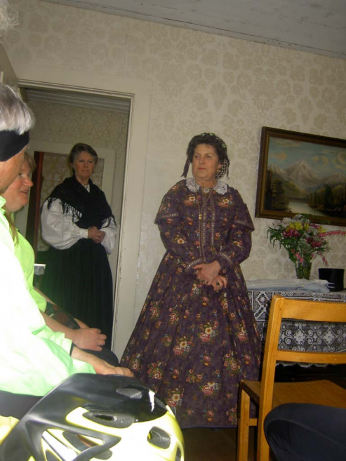
Our destination was the Ermatinger House in Oregon City where we were entertained by ladies in period costume (our hostess was Mrs. Harding) but the trip there was somewhat marred because, as Mrs Harding put it, “one of our wagons had locomotion problems” – Mike Bonnor and Cornelia Yule who owned the only tandem in the group experienced chain breakage which disrupted the derailleur, bringing them to a standstill. – At least the oxen were still healthy!
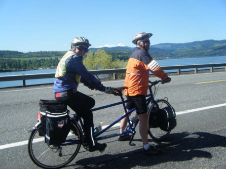
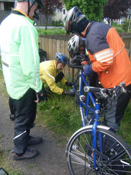
As luck would have it, we were not far away from a major Co-Motion Dealer who was able to accommodate them expeditiously and they still made it to the lunch.
The only other untoward occurrence that day was that of John Turner, who was waiting outside an elevator that we took to go up into the city when, all of a sudden, there was another loud explosion like a gunshot, magnified by the tunnel in which we were waiting, and his tube, too, had blown.
Most of us can never recall having heard one, never mind two, such “gunshot explosions” when a tube blew.
The last day (day 12) saw some hardy souls challenge the rain and several steep hills north of our accommodation while others took the opportunity to go site seeing.
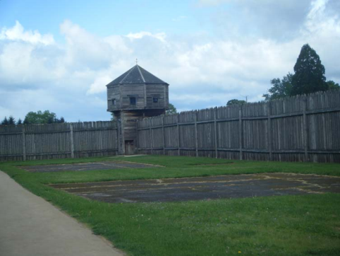
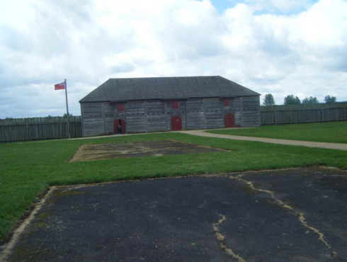 One of the interesting sites was that of Fort Vancouver, the headquarters of the Hudson’s Bay Company (Columbia Department), with an interesting tour of the Fort followed by lunch on Officer’s Row in the Grant House. Ulysses S. Grant was a one-time commander here also.
The wind-up dinner took place in an Italian Trattoria nearby when we were regaled with the Washington State folk song, composed by Woody Guthrie, by our local artiste – John Hurley, a transplanted Liverpudlian – who gave us a great rendering (a capella) of “Roll On Columbia, Roll On”. We all enthusiastically sang the easy chorus which is “Roll on Columbia roll on, roll on, Columbia roll on. Your power is turning our darkness to dawn, so roll on Columbia roll on”.
The phrase “darkness to dawn” is a reference to how hydro-electric power brings electricity to homes in rural areas which had never had it before.
[For those interested in reading a recent authorative review of the Columbia River and its importance in Northwest America, I would recommend “Fortune’s a River: Where Empires collided” by Barry Gough. One review states the following;-
“Fortune’s a River” is the most authorative and readable account to date of just how British Columbia became British and how Oregon, Washington and Alaska became American.
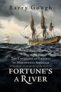 By the closing years of the 18th Century the stage was set for a major international confrontation over the northwest coast. Imperial Russia was firmly established in Alaska, Spain was extending its trade routes north from Mexico, Captain James Cook had claimed Northwest America for England (actually Britain) and Captain Robert Gray had claimed the Columbia River Region for the United States. Open warfare between Spain and England was narrowly averted during the Nootka Sound Controversy of 1789- 1794, and again between Britain and the US and the War of 1812, when a British warship seized American property in Oregon.
In Fortune’s a River, noted historian Barry Gough re-examines this imperial struggle for possession of the future British Columbia and fully evokes its peculiar drama. It turned out the great powers were reluctant conquerors in this area. Russia and Spain withdrew of their own accord. Britain was in a position to dominate but couldn’t be bothered.
The US vaguely wished to fulfill its “Manifest Destiny” by securing the northwest coast, but it was not a priority.
In the end the battle was carried on by private enterprise and individuals of vision. Alexander McKenzie established an overland route to the coast and with his partners, Simon Fraser and David Thompson, set up a network of fur trading forts south to Oregon.
US President Thomas Jefferson countered by sending out the Lewis and Clark expedition to strengthen the American claim and an American entrepreneur, John Jacob Astor, established a lonely US outpost at Astoria.
Gough examines each of the players in this territorial drama, bringing them fully to life and vividly recounting their hardships and struggles. “Fortune’s a River” is a major historical work that reads like a Wild West adventure!”]
Thus, in conclusion, and to mis-quote a famous cyclist –
“It’s not (just) about the bike(ing)”.
We did enjoy cycling over variable terrain in most of the seasons of the year, including hail, but thankfully no snow. As always happy-hour and the recounting of “war stories” featured highly on the agenda and we cannot thank Robin and Dan enough for the superb organization; the large number of tour-hosted events, including gourmet meals; the daily briefings that we all looked forward to; and the sense of visiting fairly recent history that most of us knew something about but have since learned a lot more.
Robin closed by giving us a sketch of next year’s tour – we can hardly wait.
So roll on CCCTS, roll on!
Acknowledgement: Many of the photographs contained within were contributed by Sandy Kirk, to whom thanks is due.